The Land in Peace Project
Land in Peace is a Colombian-Dutch project led by Kadaster (Cadastre, Land Registry and Mapping Agency of the Netherlands) to formalize and register land ownership in post-conflict areas through an innovative, fast and transparent methodology.
The Peace Agreement
The Colombian peace agreement was signed in November 2016 and ended a long during armed conflict between the Colombian state and the guerrilla movement FARC. The principal point of the agreement is the integral rural reform.
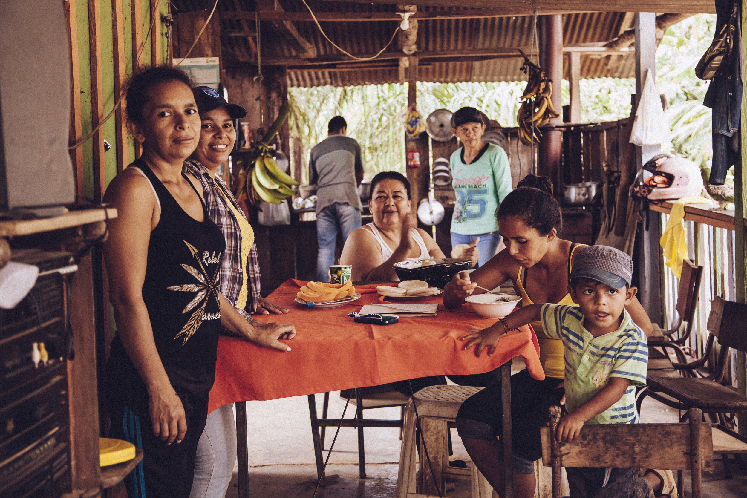
Situation
Formalization of Rights
Hector Timoté
“We never want to leave our territory, unless a villager is currently claiming our land. He says it belongs to him, but this is our land. ”
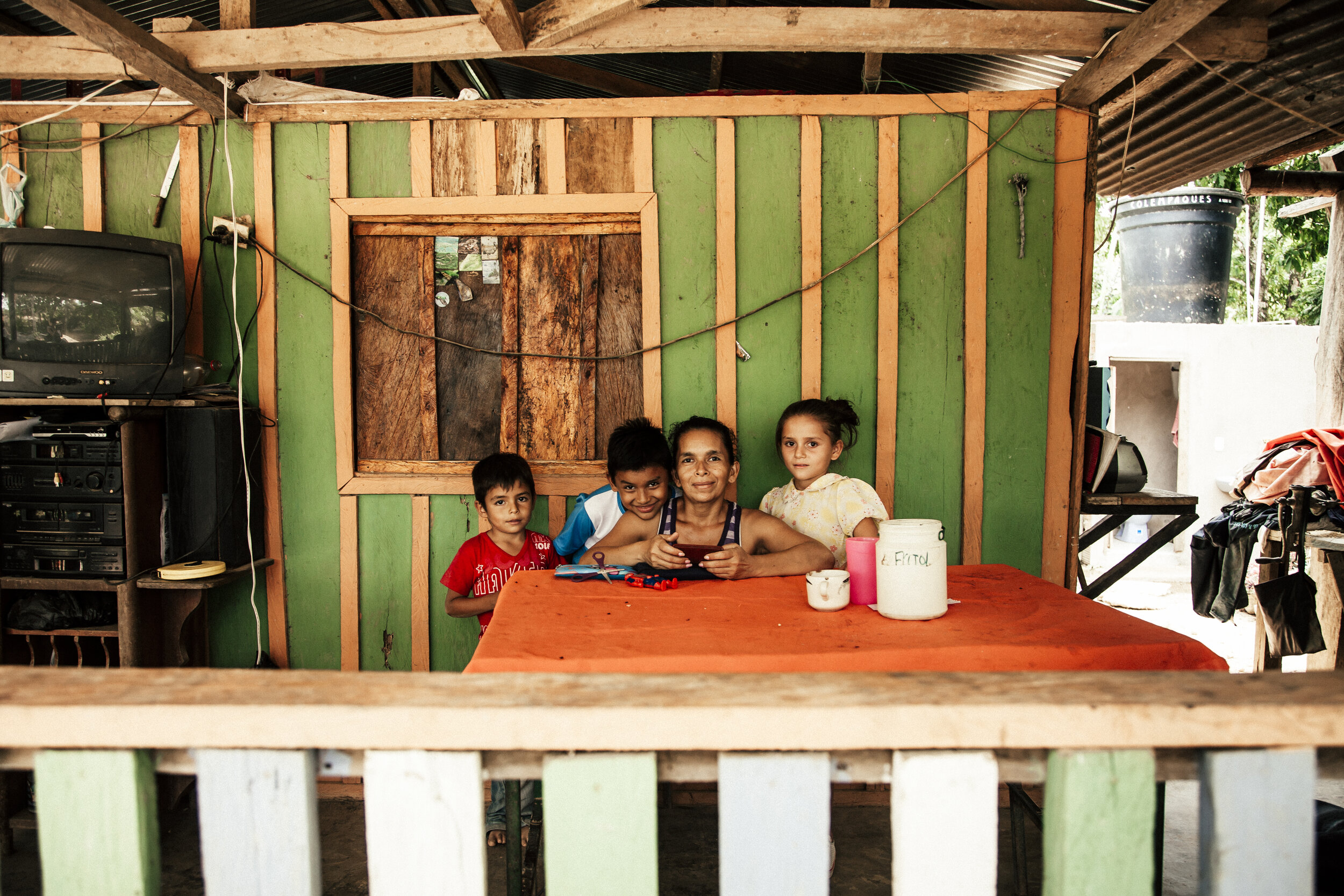
Doña Edita Socorro Gonzalez
“A land title gives me the opportunity for a dignified house."
Ingrid Villamil
17-years old Ingrid, waitress at the local restaurant in Vistahermosa, became a grassroots surveyor within a day. She is helping now the farmers in her municipality with the registering of their land.
Jaime Rojas
"I’ve been living here since long time, more or less 50 years. It is my dream to have the land property. I like to cultivate avocado and sapotes on my land. And flowers, lots of flowers."

Gabriel Ruiz
“After all the violence, and all our worries, help has finally arrived: people from the state, people from other countries, students from the university....It looks like a dream, but it is reality.”
Marcial Hurtado
“Thanks to a land title I can get a loan from the bank to invest in mechanic herbicide. I have 3 hectares of land.”
How?
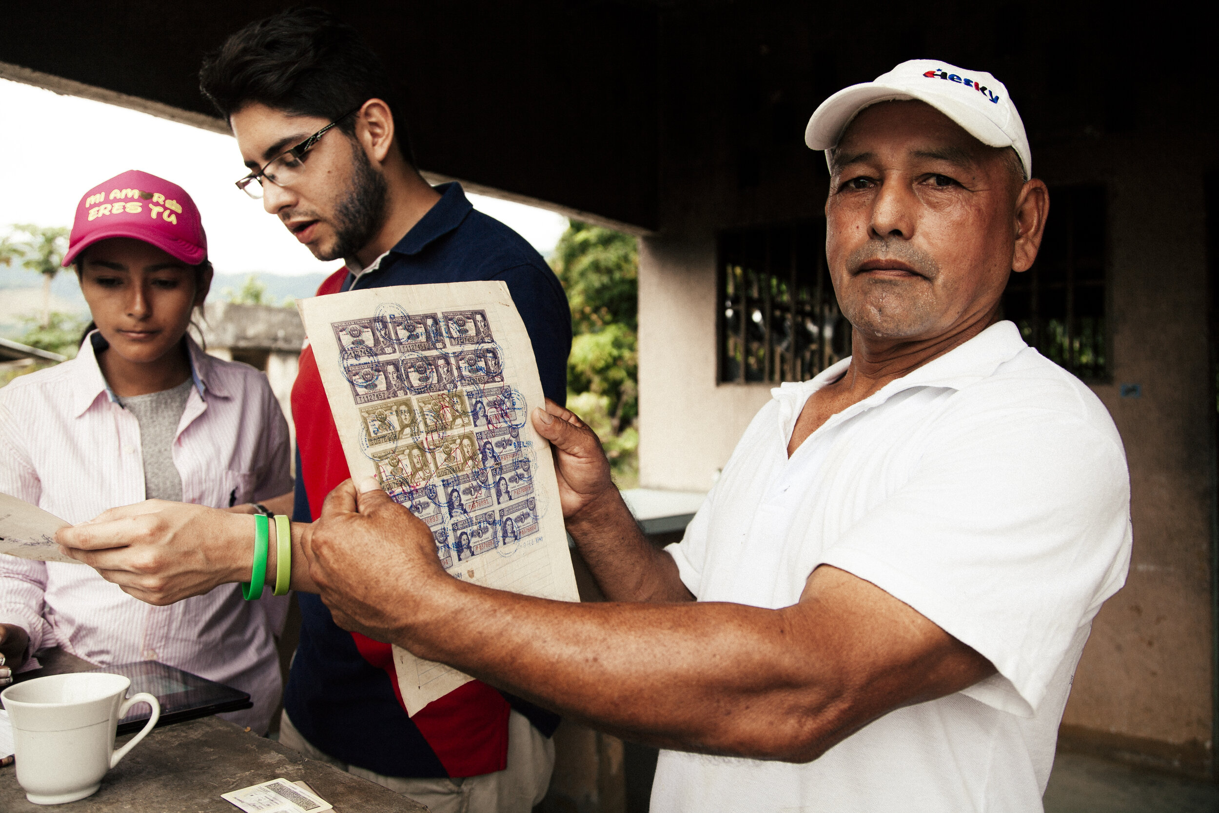
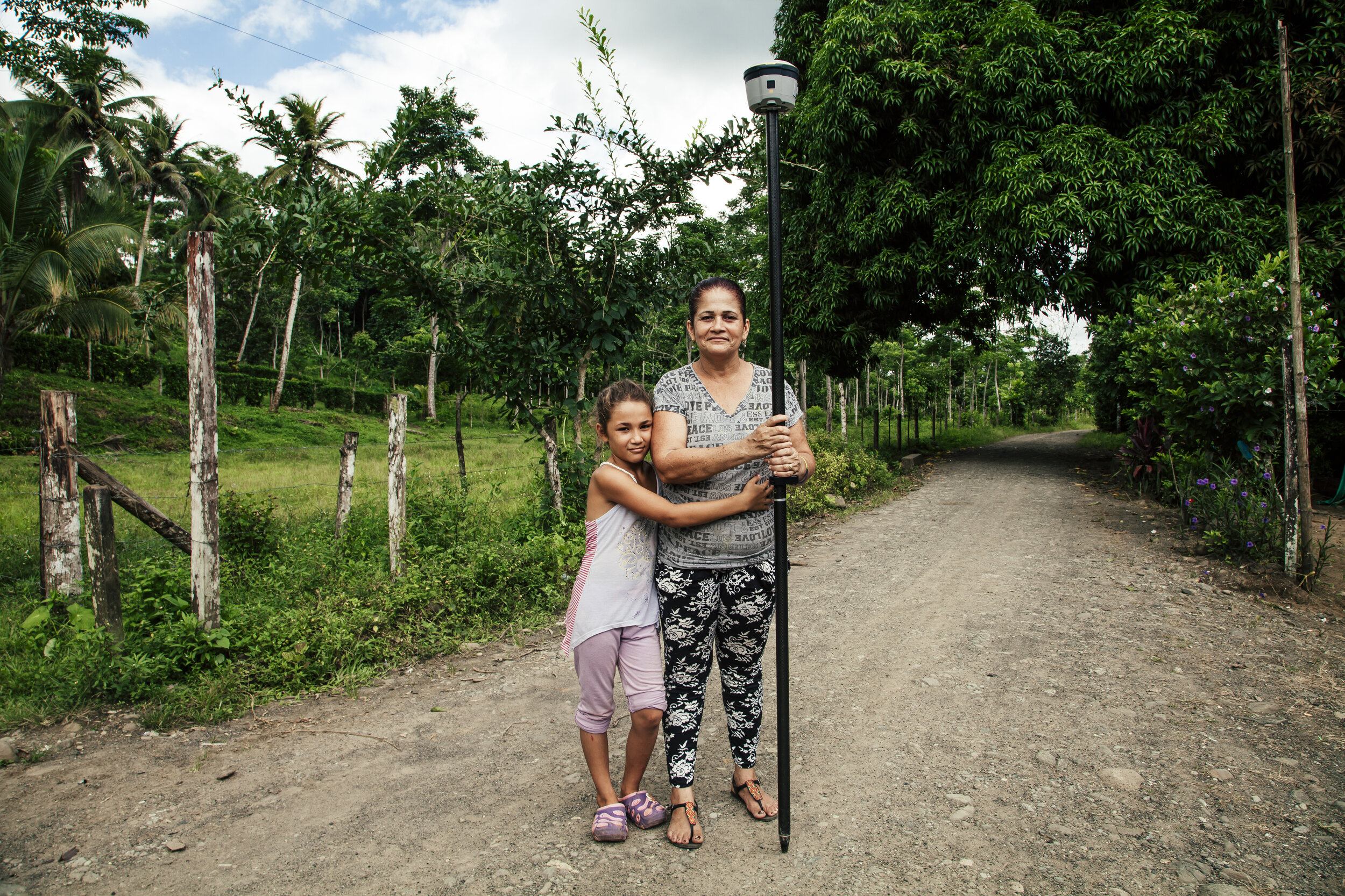
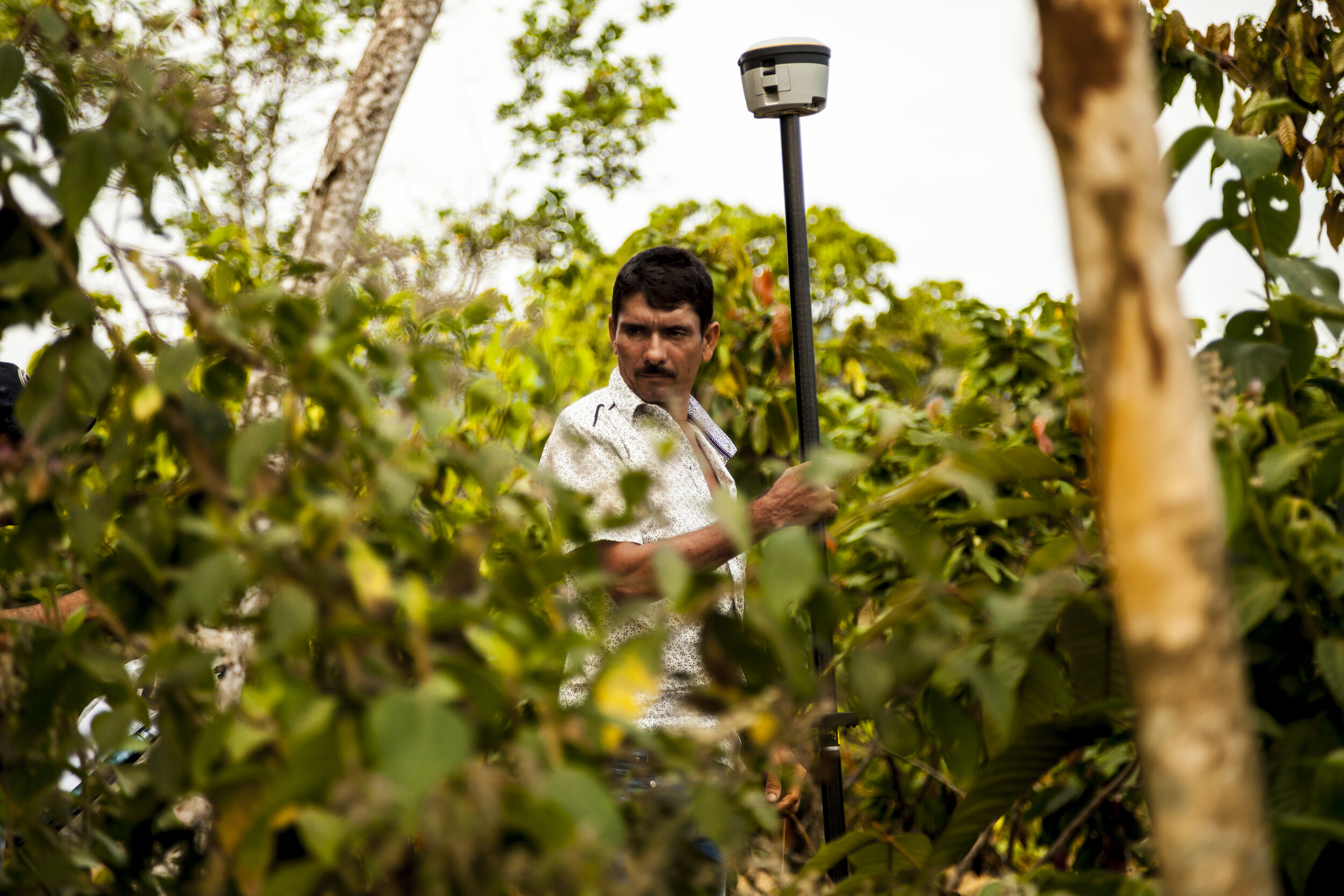
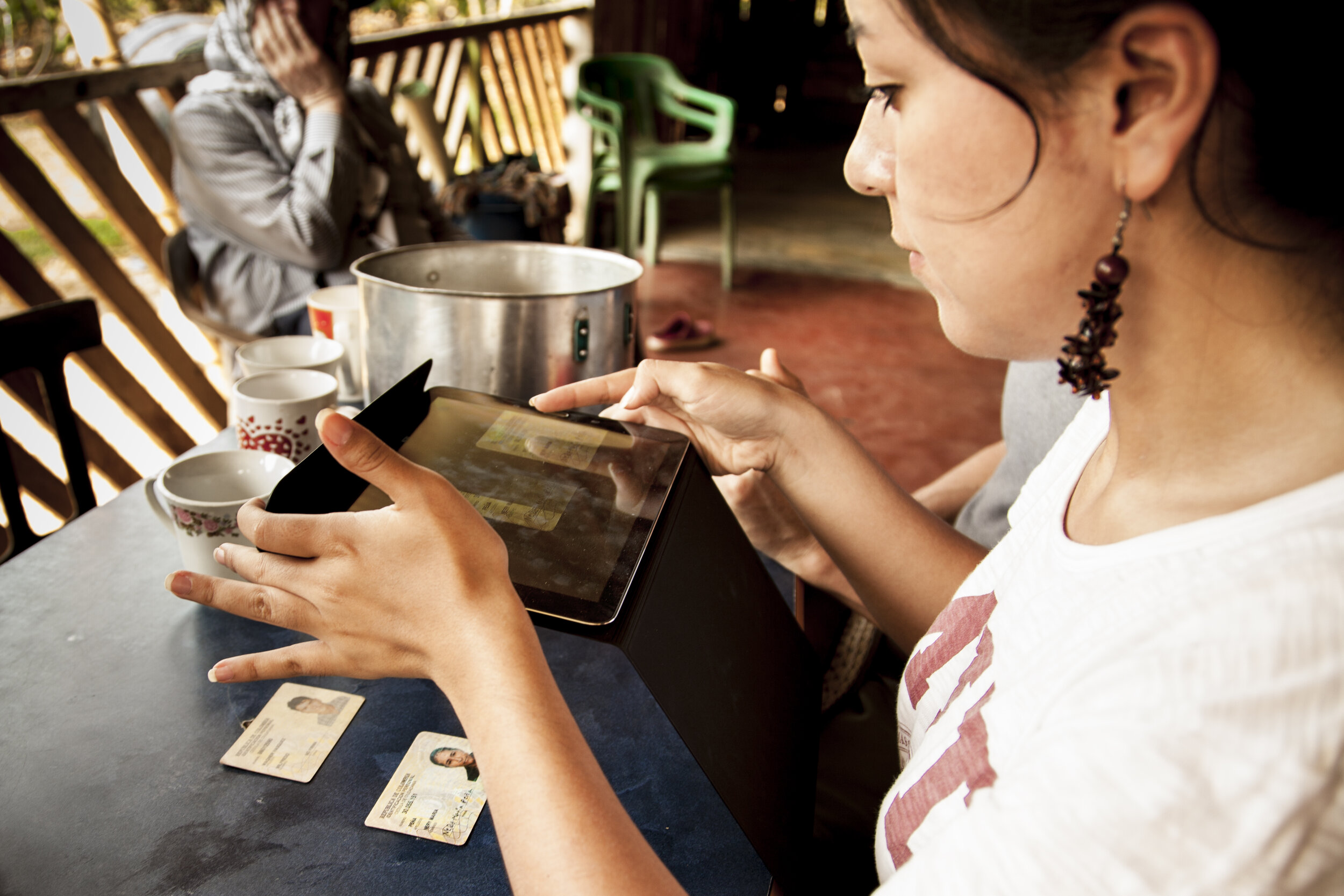
With a fast, simple and low-cost methodology for administering land: Fit For Purpose (FFP). The farmers themselves do much of the work: with a special app on smartphones or tablet they walk along the borders of their land to demarcate their plot. Also photos are made of documents (ID, tax bills, electricity bills), which relate the persons on this particular parcel to this land plot and are digitally combined with the GPS measurements of the polygons for a later communal Public Inspection. When farmers of the community mutually agree on the map they have made, land titling can be formalised.
Where?
Three pilots have been carried out in Colombia: one in the department of Antioquia (in the villages of Los Mandarinos, La Linda, El Tigre and La Balsa within the Apartadó municipality), another in the department of Meta (in the villages of Termales and Costa Rica in the Vista Hermosa municipality) and finally one in Cumaribo, Vichada.
Long Term Goals
The objective is that the collected data backed by the government, leads to cadastral maps and, more important, to land titles. These land titles give farmers legal certainty and a source of collateral, giving them access to credits and improving their access to public or private agricultural extension. This in turn will lead to increasing agricultural production in a sustainable manner.
San José de Apartadó
San José de Apartadó is a municipality in the department of Antioquia with around 32 villages made up of peasant families. They live on different agricultural products such as cocoa, bananas, plantains, and avocados. The area has been severely affected by the armed conflict. There are still active armed groups in the area.
Vista Hermosa
Vista Hermosa is a municipality in the southwest of the department of Meta. The municipality of about 11,000 inhabitants is divided into an urban center and 75 veredas. The main focus of the pilot is in the Termales and Costa Rica trails; With around 150 rural parcels, Vista Hermosa was very affected by the armed conflict, which is why there is a risk of antipersonnel mines in the area.
Cumaribo
Cumaribo is the largest municipality in Colombia, in the department of Vichada. In comparison, 121 countries in the world are smaller than this Colombian municipality. Together with IGAC, work has been done in different indigenous reserves. The pilots in Cumaribo have been carried out in the reserves and in the urban town.